Editor’s Note: Guest Author Pratibha is a technology enthusiast interested in analysing and reporting about different technologies.
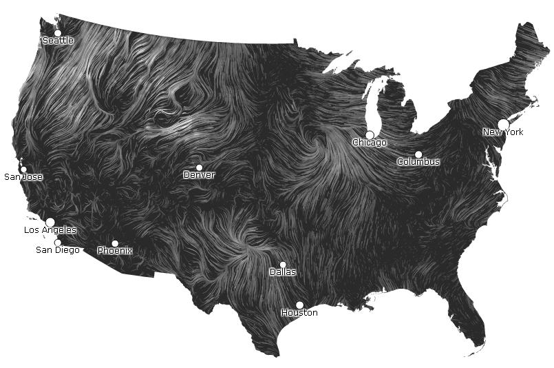
Google’s “Big Picture” visualization research group introduces a new project this week that explains a time-lapse animation of wind speeds crosswise the U.S.”An invisible, ancient source of energy surrounds us–energy that powered the first explorations of the world, and that may be a key to the future,” the artists wrote in a post. “This map shows you the delicate tracery of wind flowing over the US right now.”
“Wind Map,” shows white strips that demonstrate diverging wind speeds from 1 to 30 miles per hour. While the wind tracks crosswise the county, definite outlines appear, for instance swirls around the Rockies and powerful blasts coming off the Great Lakes. The map creators Fernanda Viegas and Martin Wattenberg, wrote that they would like to propose a visualization for the whole Earth but haven’t as yet found a global source for detailed live wind data. They got the surface wind data from the National Digital Forecast Database, which is downloaded one time an hour.


